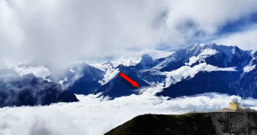
A drone was airborne over the Himalayas when the mountain behind its pilot began to come apart. The operator, a Chinese mountaineer using the name Hei Mu, was filming stunning peaks south of Langtang Lirung — a 24,000 feet (7,000 meters) giant — when a glacier high above collapsed. He didn’t realize it at the time.
The footage, posted to the Chinese social platform RedNote, is deceptively serene. Snowbound ridgelines fill the frame, the pilot visible in the shot. Then, roughly ten seconds in, small plumes of ice and rock start cascading above the cloud line, breaking like waves crashing against a pier. What looks almost picturesque from a distance was in fact the leading edge of one of the year’s deadliest natural disasters.
“I never imagined those loud noises behind me could be an ice avalanche and mudslide, nor did I expect such a huge impact,” Hei Mu wrote on RedNote. “I was too focused on aerial filming. If we had heard the sounds, we would have immediately called the police.”
BBC Verify authenticated the clip, confirming that the direction of Mu’s footage matches the surge of floodwater that later tore down the Trishuli River. The scale is hard to comprehend: the mountain’s bedrock itself crumbled, dragging the glacial ice above it sliding 5,000 feet (1,500 meters) downward. In all, an estimated 500 million tons of rock and ice came down on Langtang’s north face.
This isn’t the first camera to capture the event. Security footage previously showed rock and ice obliterating a border crossing between Nepal and China — a reminder that in disaster zones, the most important images increasingly come not from photojournalists but from consumer drones and CCTV rigs that happened to be recording.
The human cost keeps climbing. The combined death toll in Nepal and China has surpassed 950, and the Associated Press reports more than 4,400 people still missing. At least 900 workers are trapped across 12 hydropower projects damaged by the flash floods on the Nepalese side, with 500 of them stuck inside tunnels.
“These tunnels are big enough to drive trucks through,” geoscientist Jakob Steiner of the University of Graz told the AP. “And from what we understand, they have managed to get oxygen to some of those stuck inside and are trying to rescue them now. It’s a race for time, though, as people need food and water.”
For all the sophistication packed into modern camera drones, this is a stark example of what they capture when nobody plans it. A tool built for scenic aerial cinematography ended up documenting a glacier’s final seconds — and, unwittingly, the first frames of a tragedy still unfolding.